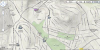
Google Maps for Uganda, sub-Saharan Africa

Google Maps in Uganda can be viewed via the “Map” button which shows the traditional map view for ?nding an address or planning directions. To explore in more detail users can choose the “Satellite” button, which includes satellite and aerial photographs. The “Terrain” view shows the physical geography of a place (the hills and mountains).
Google Maps are also now accessible for 29 other new African countries. This follows earlier launches of Google Maps in Kenya and South Africa.
Joe Mucheru, Google's regional lead, sub-Saharan Africa, said: "This is a very exciting pan-African launch and we are delighted to be improving our maps functionality for Africa, helping to make information about the continent readily available. Google Maps isn't just searchable digitised maps helping you to find a local place, service or product - it is about making information with a geographical dimension available to everyone and allowing users to update the maps and develop on top of them. We believe that more accurate, representative local information can greatly improve the breadth of information available about a given area and in turn can help efforts to bolster tourism and business investment."
Rachel Payne, country manager, Google Uganda, said: "Building on the launch of Google Earth Outreach Africa and our Google Maps training sessions at Africa GIS in Kampala last October, today's Maps launch in Uganda is a sign of progress in localising our geo products, and of further exciting things ahead. We want to show that the Internet is not just a place to find and consume information, but a place for Africans to create and contribute their own."
Users in Uganda can see a ready-made map of Kampala at: My Map Kampala.


